Earth from space
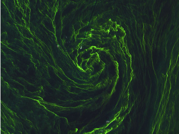
Despite only being in orbit for a matter of weeks, Sentinel-2A has exceeded expectations with this image of algal bloom in the Baltic Sea. The second of the Sentinel fleet (launched June 2015) was initially built as a land …
The International Partnerships in Space Programme (IPSP) is the newest programme in the Agency’s portfolio. It's an exciting £32 million international programme established and led by the UK Space Agency.
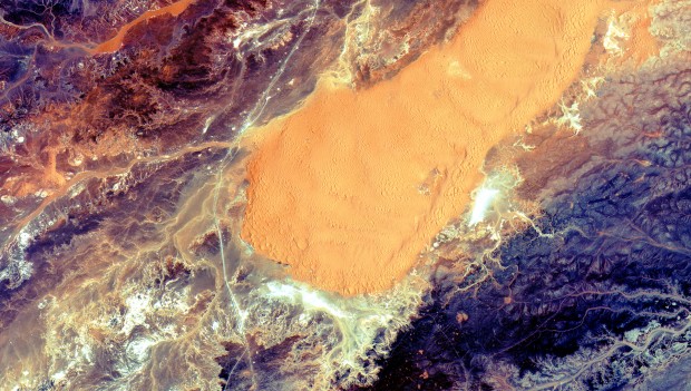
Another gorgeous image from Sentinel-2A captured of the Sahara desert in central Algeria.
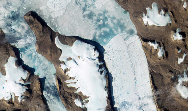
Last month, (July 2015) Europe’s Copernicus programme released this fascinating image of a glacier in Greenland. Environmental information helps us understand how our planet is changing and the role man-kind has to play in this. The Copernicus programme uses the …
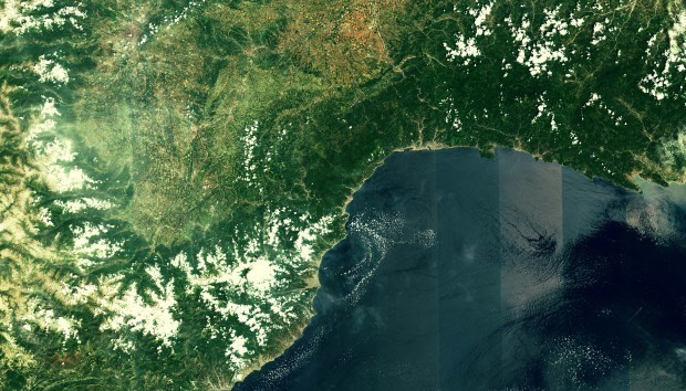
Taken just 4 days after launch, this first image from Sentinel-2A shows the coastal mountains of France and Italy. Each detector in the multispectral instrument has a slightly different viewing direction. These different directions translate into marginal differences causing the …
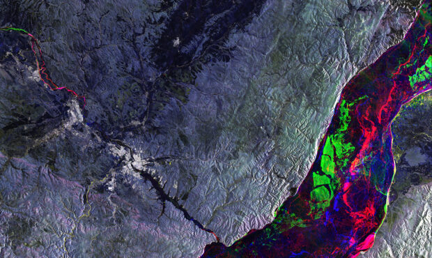
An image over Russia’s Siberia region was released on the anniversary of Sentinel-1A’s orbit.
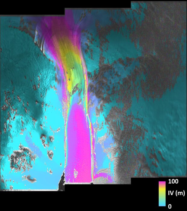
This combined image of scans taken by Sentinel-1A’s radar shows the fast-moving Pine Island glacier, which flowed about 100 m in less than 2 weeks (in pink). Light blue represents stable ice on either side of the stream. Pine Island …